Mapping Memorable Places
The lake where you spent your childhood summers. The city where you fell in love. Your favorite National Park. Let us use satellite photos to transform your favorite memories into Art. Browse the gallery of satellite imagery available immediately for digital download or prints, or submit a request for a free preview of a specific time and place. Have a unique request? Contact Us.
Featured Framed Prints
Real Satellite Imagery | Custom Processed | Shipped to Your Door
Bring Earth’s beauty on to your wall with these high-quality framed prints, created using authentic imagery from a variety of sources. Each piece highlights a unique location on Earth — from coastlines and mountain ranges to deserts, cities, and lakes — processed for color, clarity, and aesthetic balance. Perfect for wall art, galleries, or businesses.
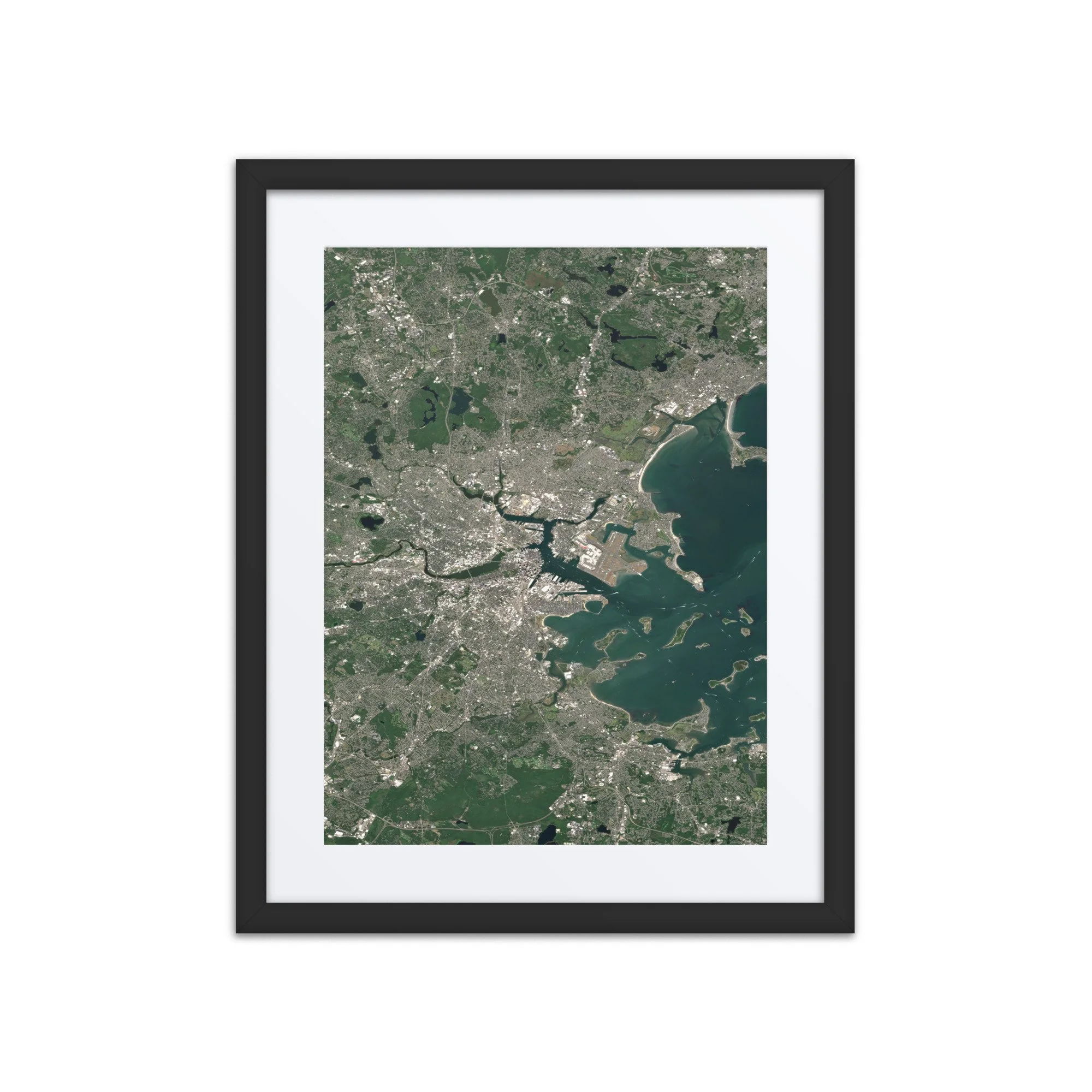
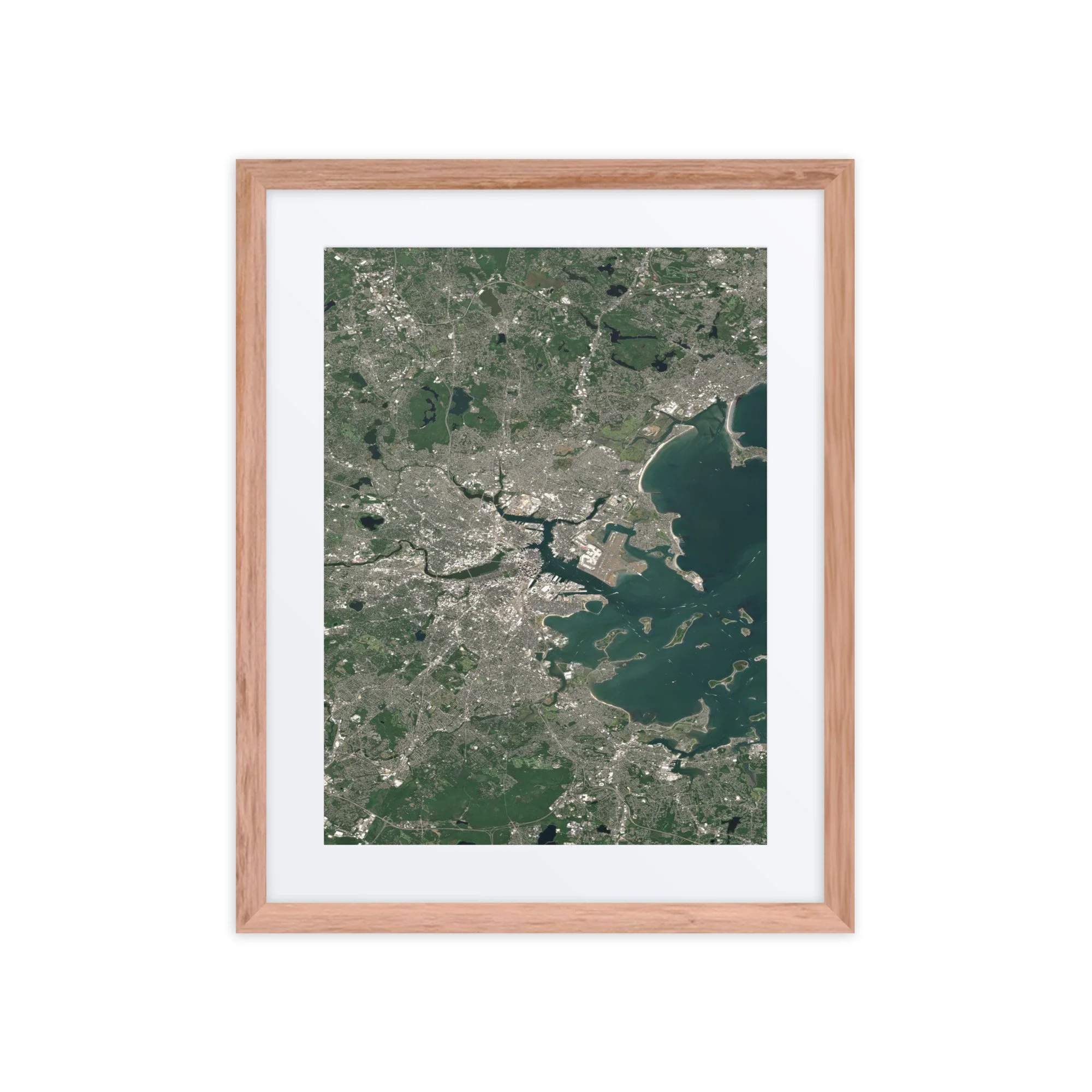
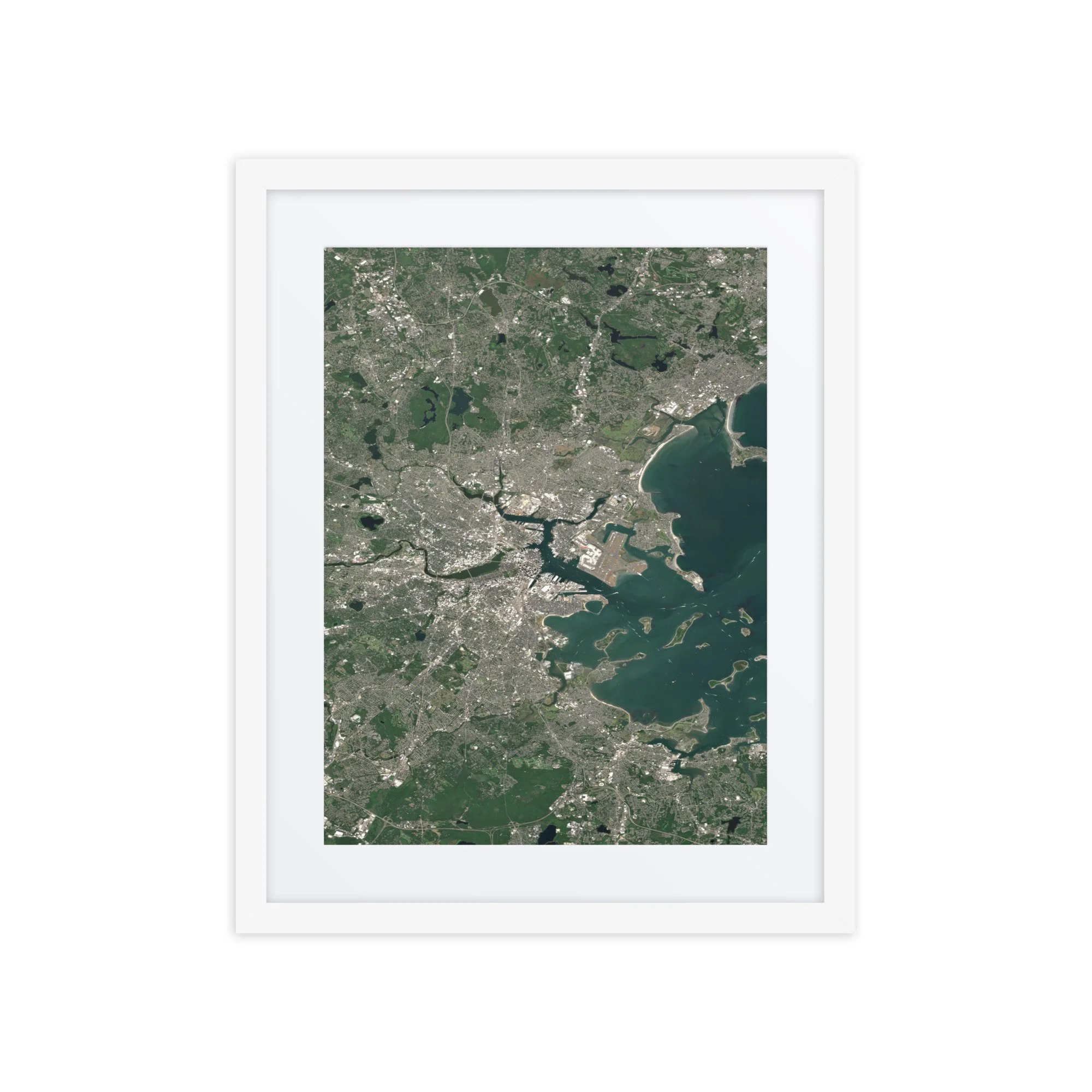
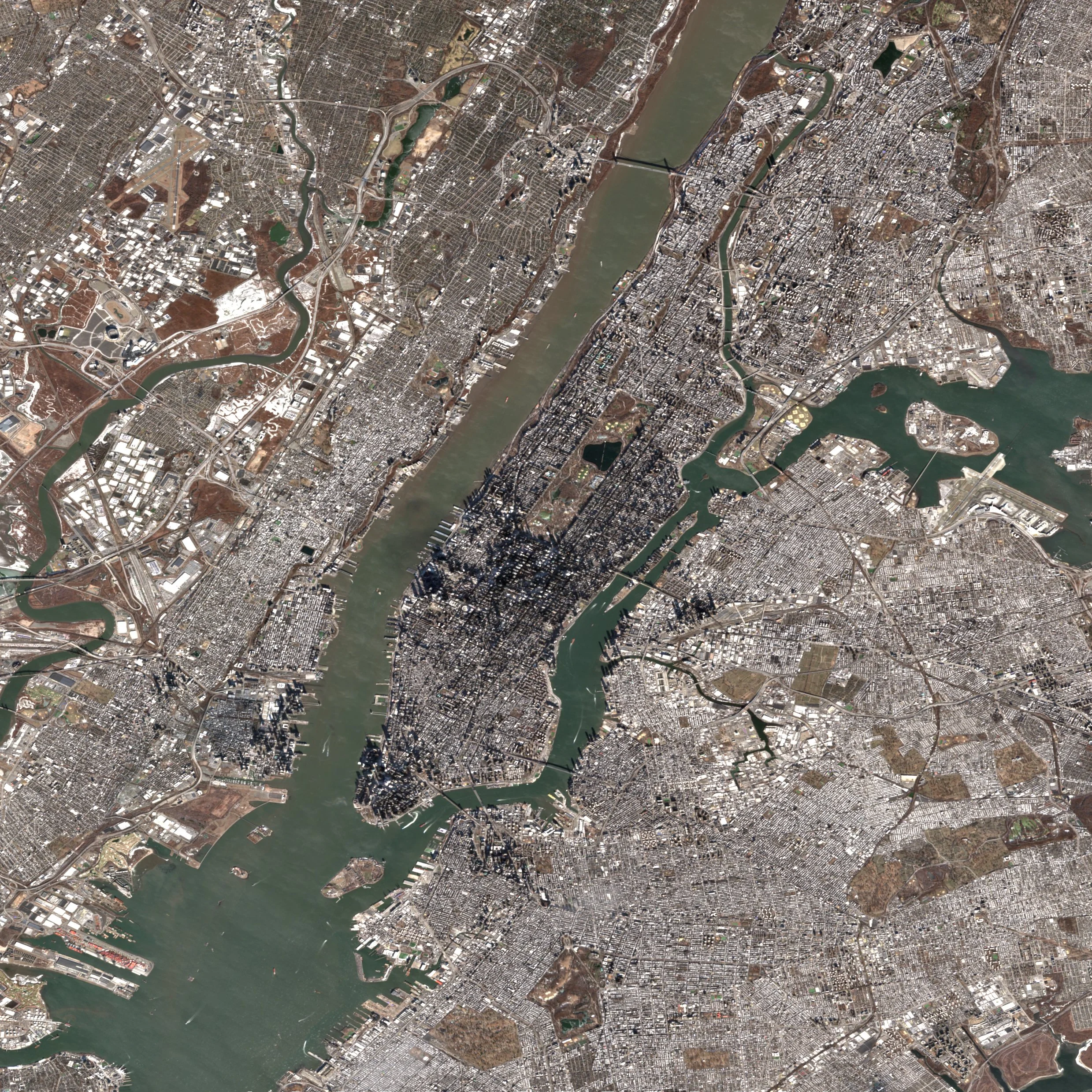
Visible features include downtown Boston, the dense urban neighborhoods surrounding the Charles River, and Logan International Airport, whose runways extend prominently into the harbor. The surrounding suburbs and forested areas appear in rich green tones, contrasting with the tightly packed urban core and historic street patterns that define one of America’s oldest cities.
This satellite view highlights Boston’s unique relationship with the Atlantic Ocean—where maritime geography, modern infrastructure, and centuries of urban development converge in a single, striking perspective.
Make a statement in any room with this framed poster, printed on thick matte paper.
• Ayous wood .75″ (1.9 cm) thick frame from renewable forests
• Paper thickness: 10.3 mil (0.26 mm)
• Paper weight: 189 g/m²
• Lightweight
• Acrylite front protector
• Hanging hardware included
• Blank product components sourced from Japan and the US
This product is made especially for you as soon as you place an order, which is why it takes us a bit longer to deliver it to you. Making products on demand instead of in bulk helps reduce overproduction, so thank you for making thoughtful purchasing decisions!
In compliance with the General Product Safety Regulation (GPSR), Any Place From Space and SINDEN VENTURES LIMITED ensure that all consumer products offered are safe and meet EU standards. For any product safety related inquiries or concerns, please contact our EU representative at gpsr@sindenventures.com. You can also write to us at contact@anyplacefromspace.com or Markou Evgenikou 11, Mesa Geitonia, 4002, Limassol, Cyprus.
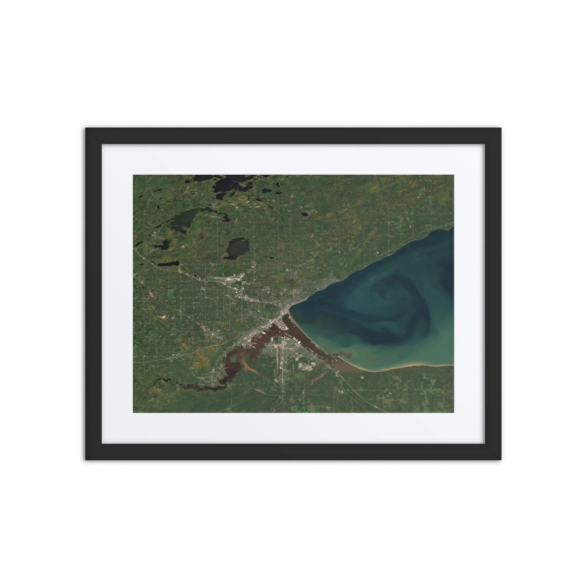
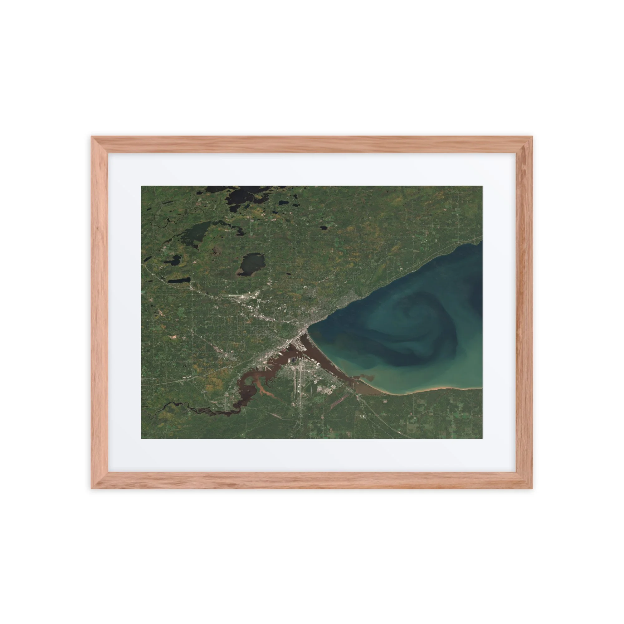
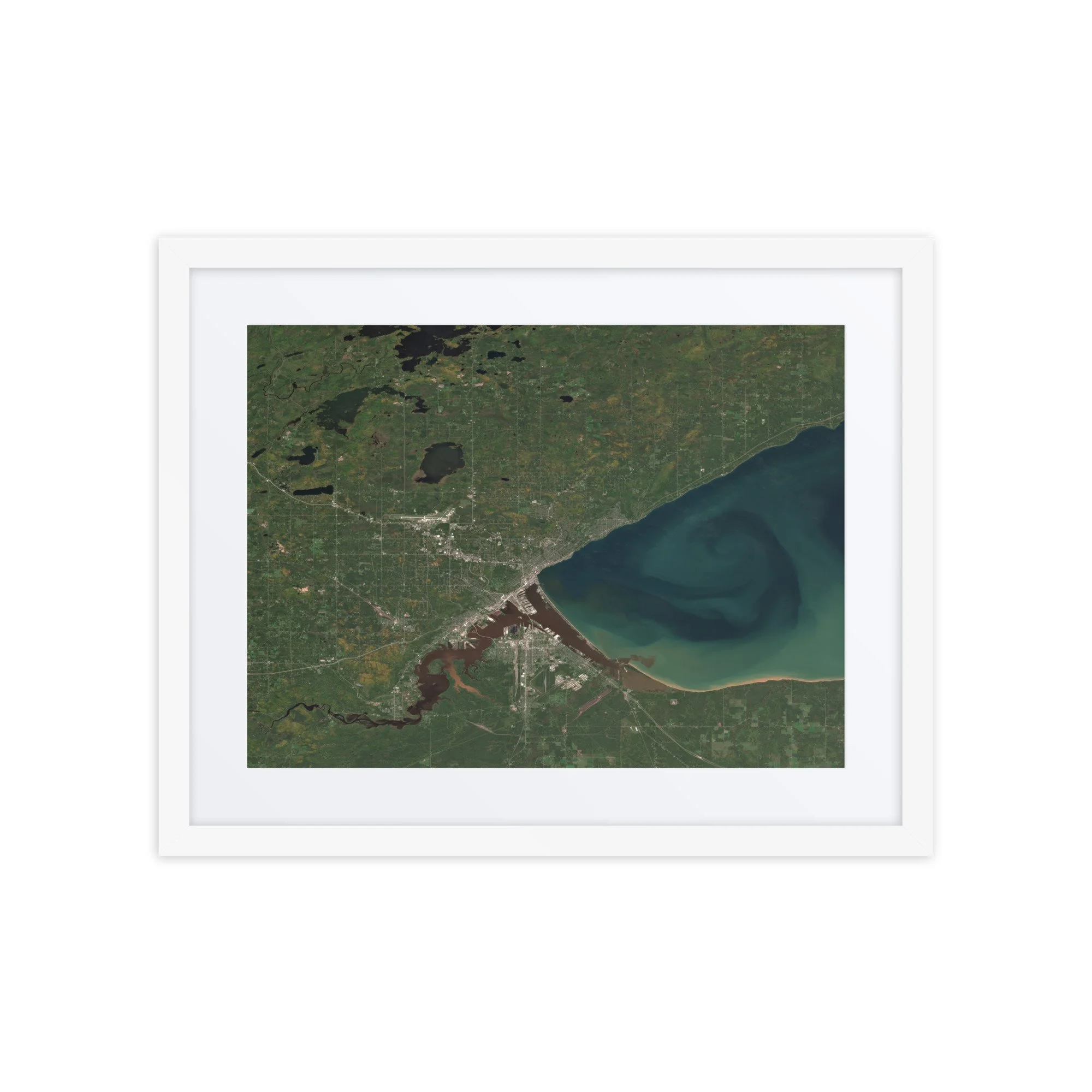
High-resolution Duluth, Minnesota satellite image captured September 27, 2025. View Duluth from space with vivid Lake Superior water colors and fall foliage. Perfect for wall art, digital download, or map decor.
Duluth, Minnesota – September 27, 2025
This image showcases Duluth, Minnesota on September 27, 2025. From space, the city stretches along the rugged northwestern shoreline of Lake Superior, where the deep blue waters dramatically shift into swirling gradients of turquoise and green near the harbor and shoreline.
Visible features include the Duluth Harbor and Canal Park, the iconic Aerial Lift Bridge, and the long sandbar of Minnesota Point extending into the lake. The St. Louis River flows in from the west, its darker waters mixing with Lake Superior to create striking color contrasts clearly visible from orbit. Inland, the surrounding forests display early fall leaf colors, with patches of gold, amber, and deep green spreading across northeastern Minnesota’s landscape.
The combination of autumn foliage and dynamic water color patterns makes this Duluth satellite image a truly unique seasonal capture of the city from space.
Make a statement in any room with this framed poster, printed on thick matte paper.
• Ayous wood .75″ (1.9 cm) thick frame from renewable forests
• Paper thickness: 10.3 mil (0.26 mm)
• Paper weight: 189 g/m²
• Lightweight
• Acrylite front protector
• Hanging hardware included
• Blank product components sourced from Japan and the US
This product is made especially for you as soon as you place an order, which is why it takes us a bit longer to deliver it to you. Making products on demand instead of in bulk helps reduce overproduction, so thank you for making thoughtful purchasing decisions!
In compliance with the General Product Safety Regulation (GPSR), Any Place From Space and SINDEN VENTURES LIMITED ensure that all consumer products offered are safe and meet EU standards. For any product safety related inquiries or concerns, please contact our EU representative at gpsr@sindenventures.com. You can also write to us at contact@anyplacefromspace.com or Markou Evgenikou 11, Mesa Geitonia, 4002, Limassol, Cyprus.
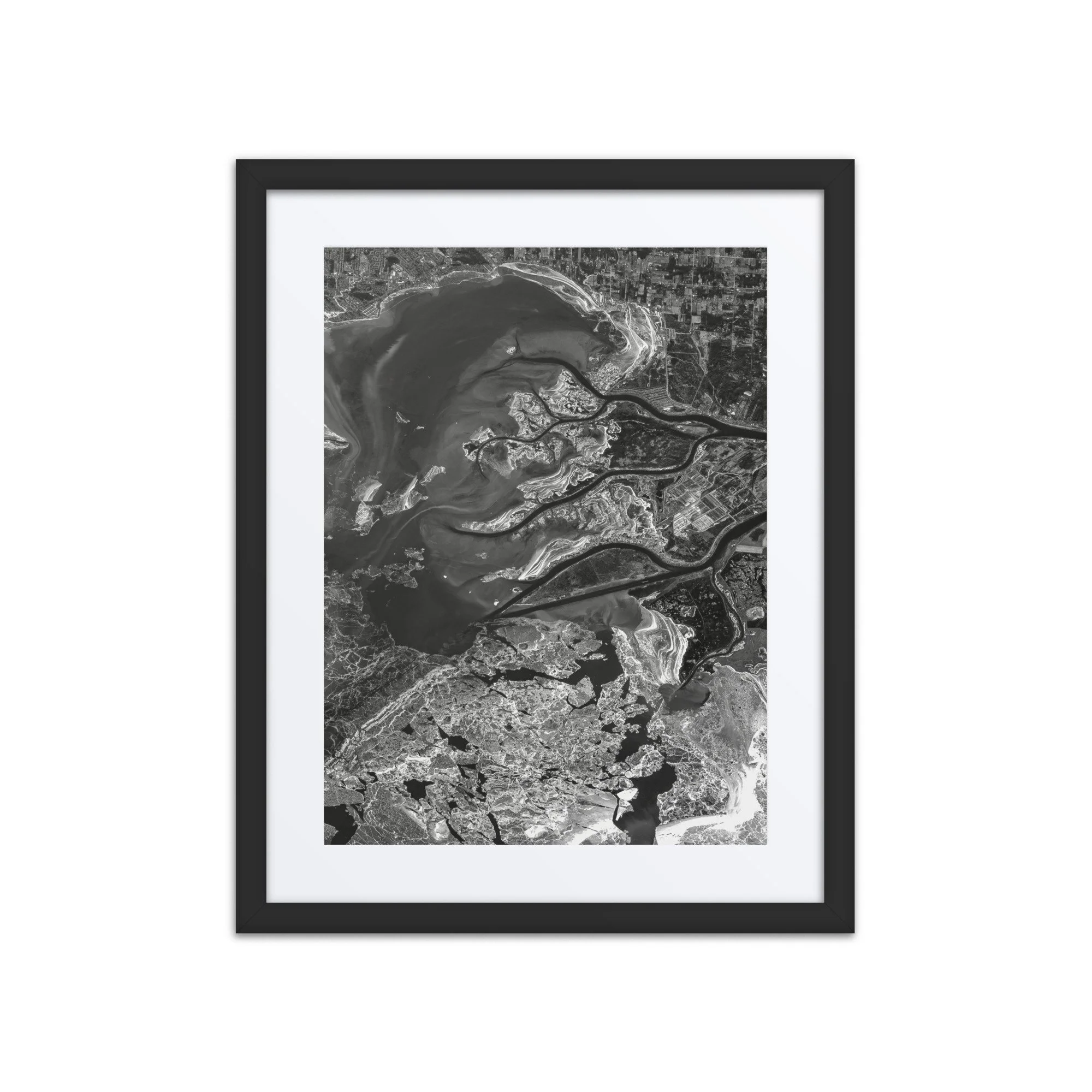
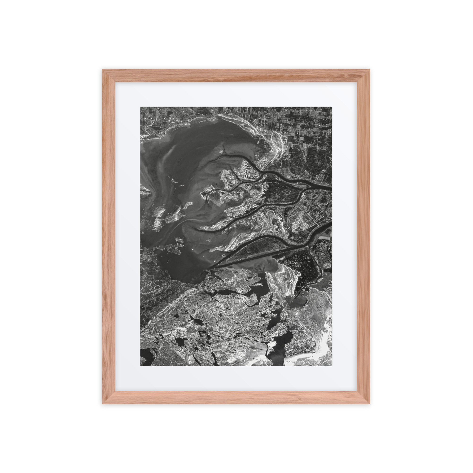
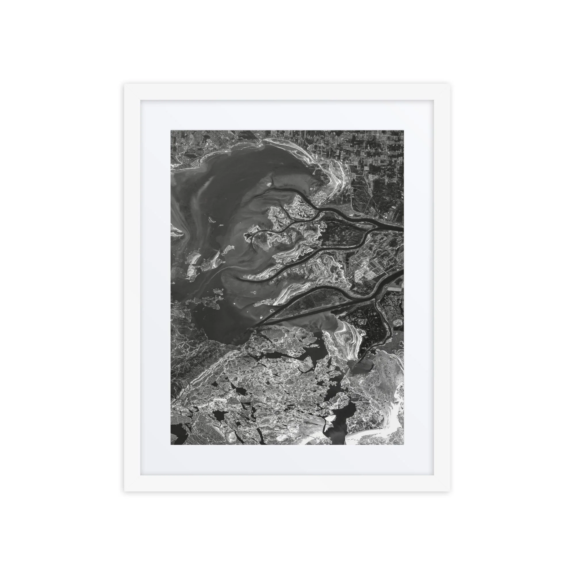
Lake St. Clair, Michigan – January 8, 2026
This image showcases Lake St. Clair on January 8, 2026. Visible features include the intricate channels of the St. Clair River Delta, the flowing connection between Lake Huron and Lake Erie, and a dramatic mix of winter ice and open water across the lake’s surface.
In the southern portion of the image, fractured sheets of ice float across deep green water, forming abstract patterns that resemble shattered glass. To the north and east, sediment-rich water from the river system creates swirling gradients of teal and turquoise, highlighting the dynamic mixing of freshwater entering the lake. The branching wetlands and marshlands of the delta stand out in earthy browns and greens, contrasting beautifully with the frozen shoreline and icy textures below.
Captured from orbit using modified Copernicus Sentinel-2 data (2026), this winter view of Lake St. Clair reveals the powerful seasonal forces shaping the Great Lakes region — where river flow, sediment transport, and freezing temperatures combine to create an ever-changing landscape best appreciated from space.
Make a statement in any room with this framed poster, printed on thick matte paper.
• Ayous wood .75″ (1.9 cm) thick frame from renewable forests
• Paper thickness: 10.3 mil (0.26 mm)
• Paper weight: 189 g/m²
• Lightweight
• Acrylite front protector
• Hanging hardware included
• Blank product components sourced from Japan and the US
This product is made especially for you as soon as you place an order, which is why it takes us a bit longer to deliver it to you. Making products on demand instead of in bulk helps reduce overproduction, so thank you for making thoughtful purchasing decisions!
In compliance with the General Product Safety Regulation (GPSR), Any Place From Space and SINDEN VENTURES LIMITED ensure that all consumer products offered are safe and meet EU standards. For any product safety related inquiries or concerns, please contact our EU representative at gpsr@sindenventures.com. You can also write to us at contact@anyplacefromspace.com or Markou Evgenikou 11, Mesa Geitonia, 4002, Limassol, Cyprus.
Featured Digital Prints
Real Satellite Imagery | Custom Processed | Instant Download
Bring Earth’s beauty on to your screen with these high-resolution digital downloads, created using authentic imagery from a variety of satellite and aerial photography sources. Each piece highlights a unique location on Earth — from coastlines and mountain ranges to deserts, cities, and lakes — processed for color, clarity, and aesthetic balance. Perfect for printing, framing, or displaying digitally.

This image showcases Lake Tahoe on July 4, 2025. The deep blues of the lake contrast vividly against the rugged Sierra Nevada terrain, with the lighter turquoise shallows near the shorelines clearly visible. The scene captures the area’s summer vibrancy on a day when thousands gather to celebrate Independence Day along Tahoe’s scenic beaches. Zoom in close and you will see many boats out on the lake celebrating the Fourth of July.

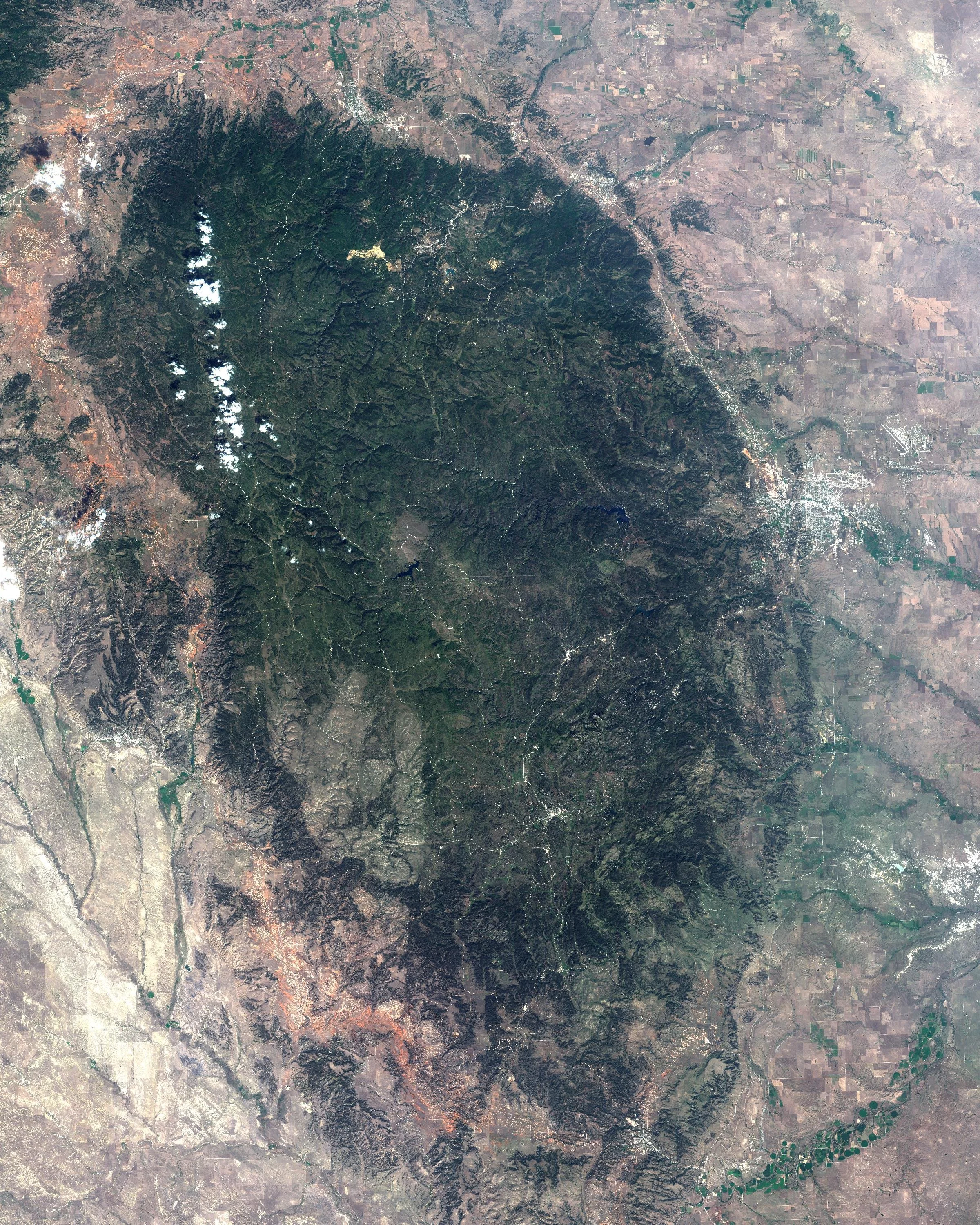
This natural color satellite image showcases Zion National Park, Utah on July 28, 2025. Visible features include the park’s dramatic sandstone cliffs, deep slot canyons, and the winding path of the Virgin River cutting through the valley. Zion is one of the most visited national parks in the United States, famed for its towering red rock formations, scenic hikes, and breathtaking desert landscapes. This high-resolution image makes a great wallpaper, desktop background, or a unique visual element for your own web content.
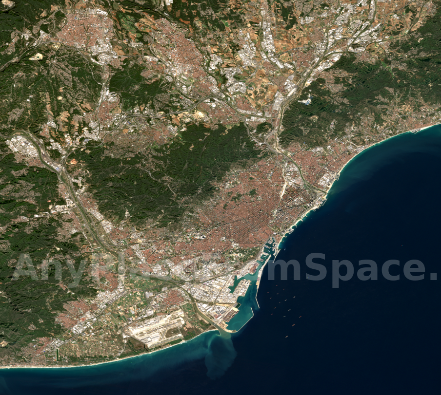
This image showcases Barcelona, Spain on November 27, 2025. The distinctive grid pattern of the Eixample district stands out prominently, framed by the surrounding hills of Collserola and the deep blue waters of the Mediterranean Sea. Along the coastline, you can see Barcelona’s beaches curving gently toward the busy Port of Barcelona, where ships line the harbor and sediment plumes form dynamic patterns in the shallow coastal waters. Further inland, the mix of historic neighborhoods, modern development, and green urban spaces reveals the rich complexity of one of Europe’s most vibrant cities.
About Us
At Any Place From Space, we transform real satellite imagery and aerial photography into personalized works of art — turning the places that matter most to you into stunning visual keepsakes.
Whether it's the lake where you spent every summer, the city where you fell in love, or the mountains you climbed on your honeymoon, our mission is simple:
To map your memories using actual satellite data from space.
We use high-resolution imagery from a variety of sources, paired with custom processing and modern design. You choose the location and date — we take care of the rest. From digital downloads to professional-quality prints, we make it easy to own a little piece of Earth as seen from orbit.
Every image is unique. Every place tells a story.
Any place. Any date. From space.
Contact Us
If you have a unique request or are having issues submitting a request, please reach out. We can’t wait to hear from you!