Our Services
Whether you are looking for a digital download to use as a wallpaper, a new time and place to create your own map, or a printed, framed, and shipped masterpiece arriving at your doorstep, Any Place From Space has you covered.
Custom Satellite Image vs. Custom Aerial Image — What’s the Difference?
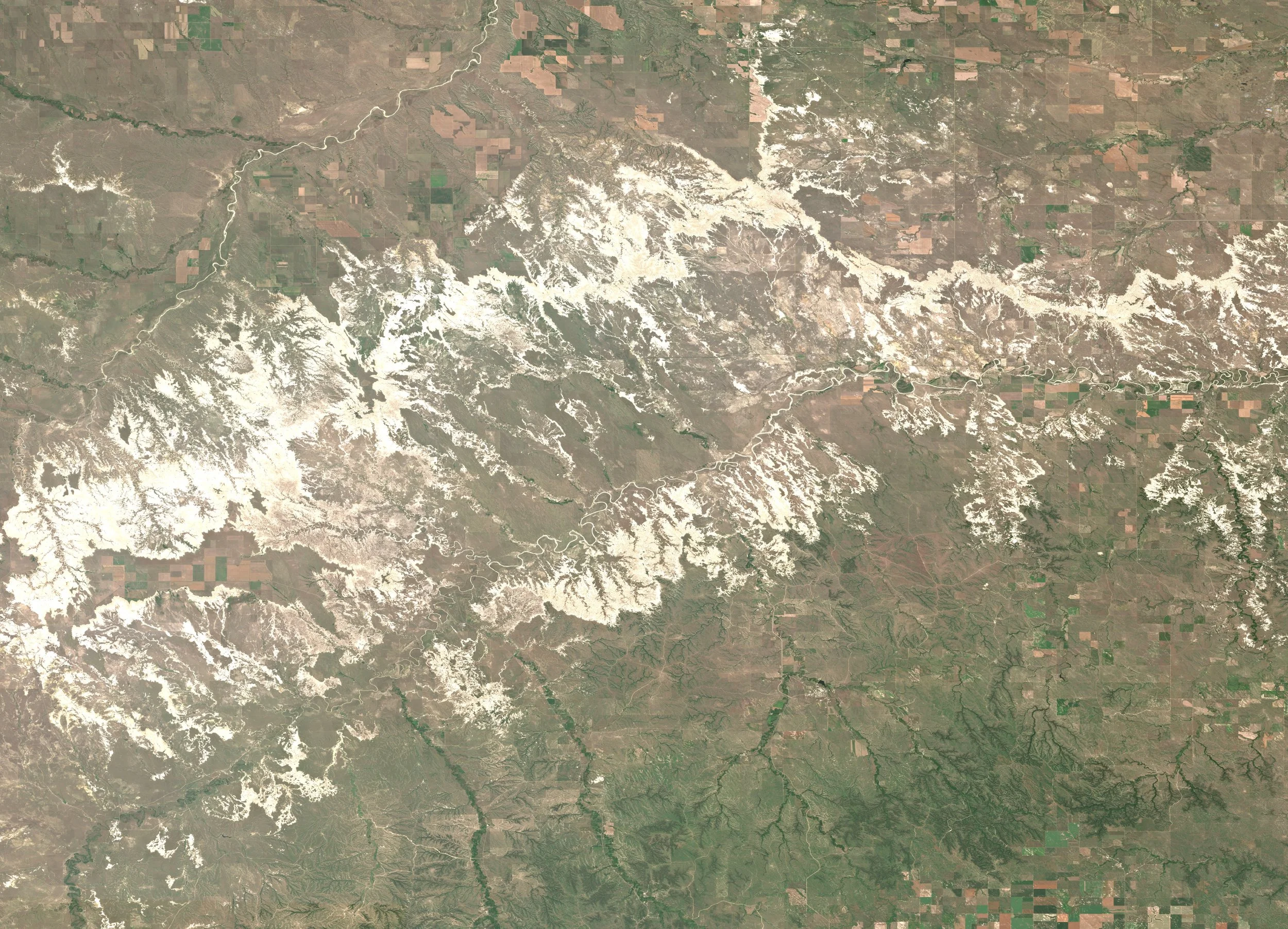
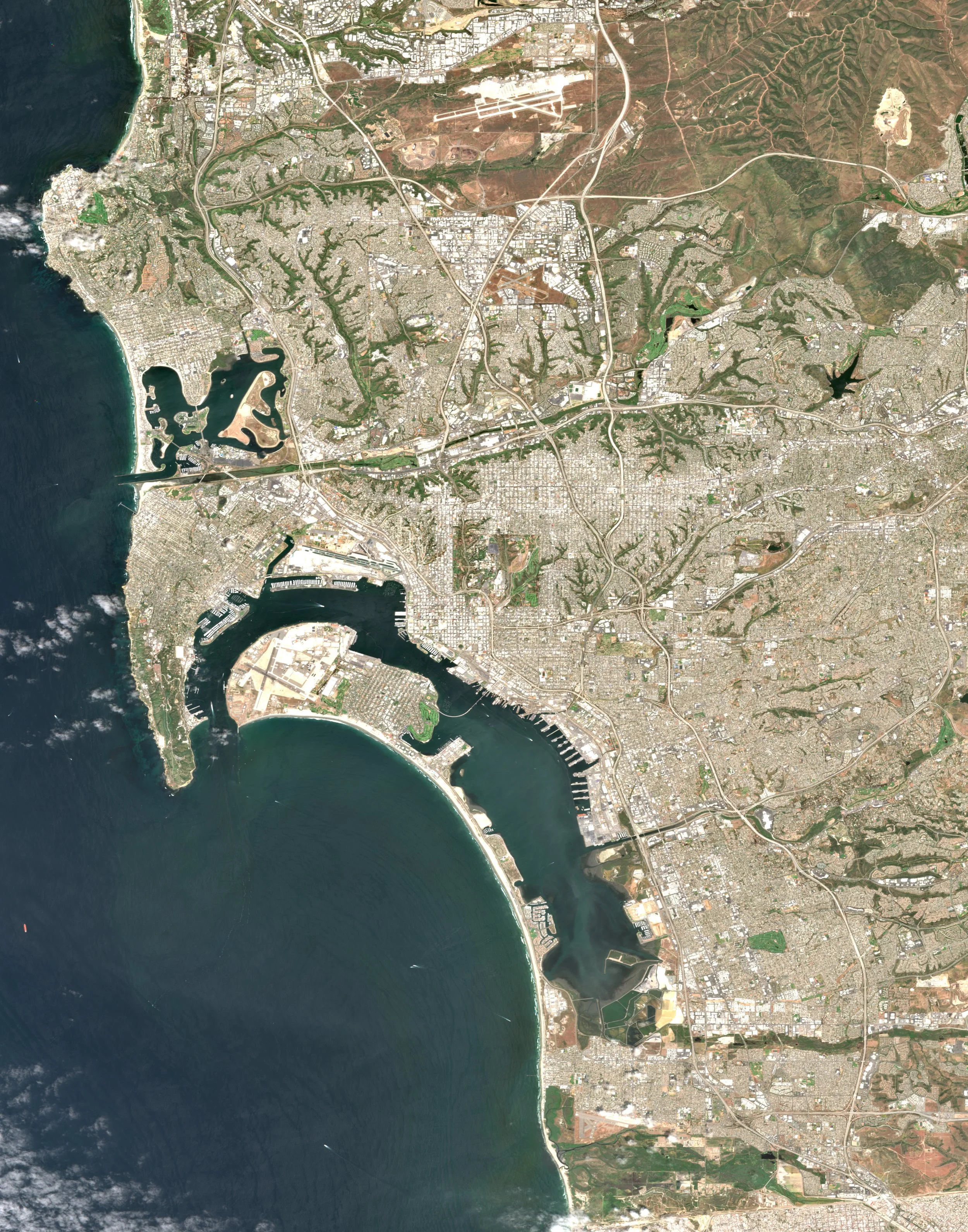
Custom Satellite Image Requests are ideal for capturing places at a local to regional scale. This option works best for cities, lakes, national parks, coastlines, and other large areas. Satellite imagery has excellent availability, meaning it’s the best choice if you’re set on a specific date or season. Most requests can be fulfilled quickly and reliably.
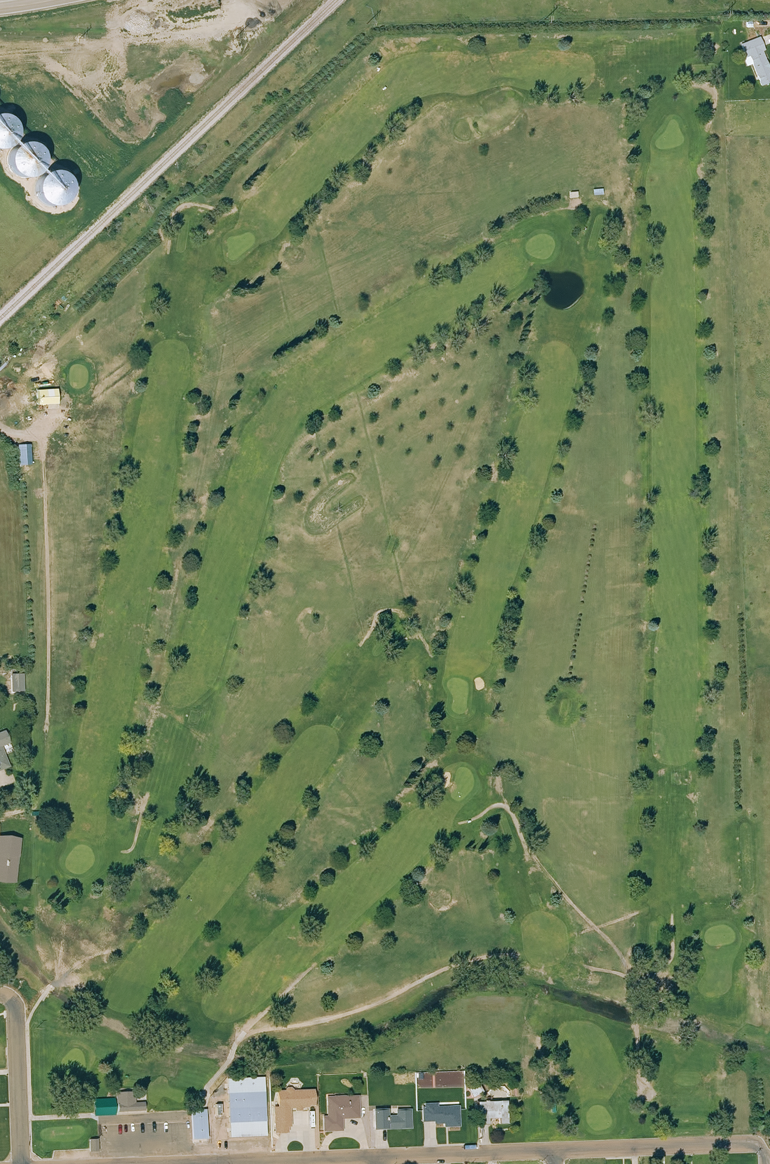
Custom Aerial Image Requests offer much higher spatial resolution, revealing fine-scale details not visible from satellites. This makes aerial imagery perfect for golf courses, real estate, farms, and small properties. However, aerial data has limited availability, and matching an exact date is often unlikely.
In short:
Choose Satellite for broader areas and better date availability
Choose Aerial for maximum detail at a smaller scale, with less flexibility on timing
If you’re unsure which option is best for your request, we’re always happy to help guide you. Check out the examples above and below to visually compare the differences.
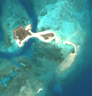
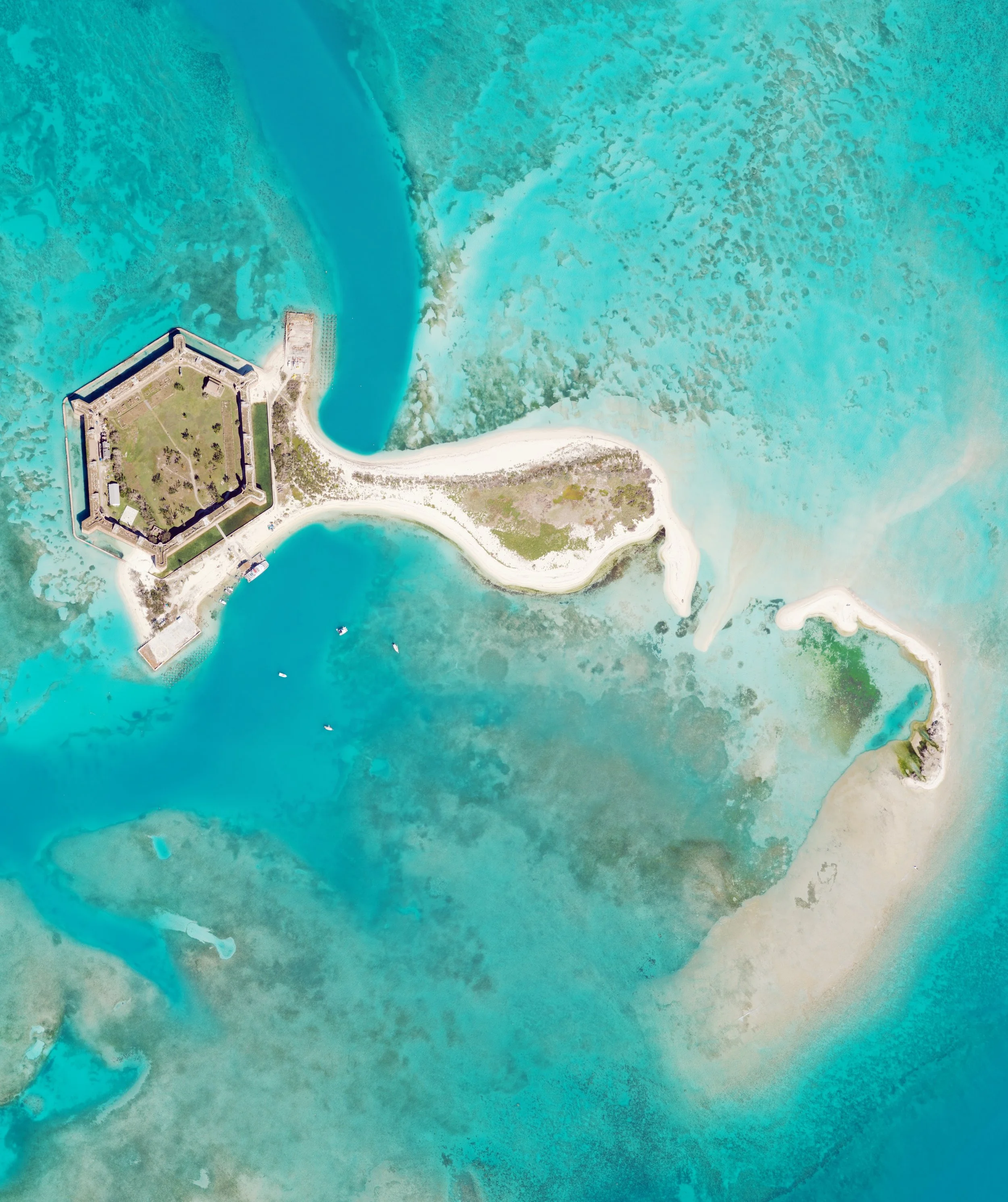
Zoomed in example of a Custom Satellite Image over Dry Tortugas National Park
Example of a Custom Aerial Image over Dry Tortugas National Park
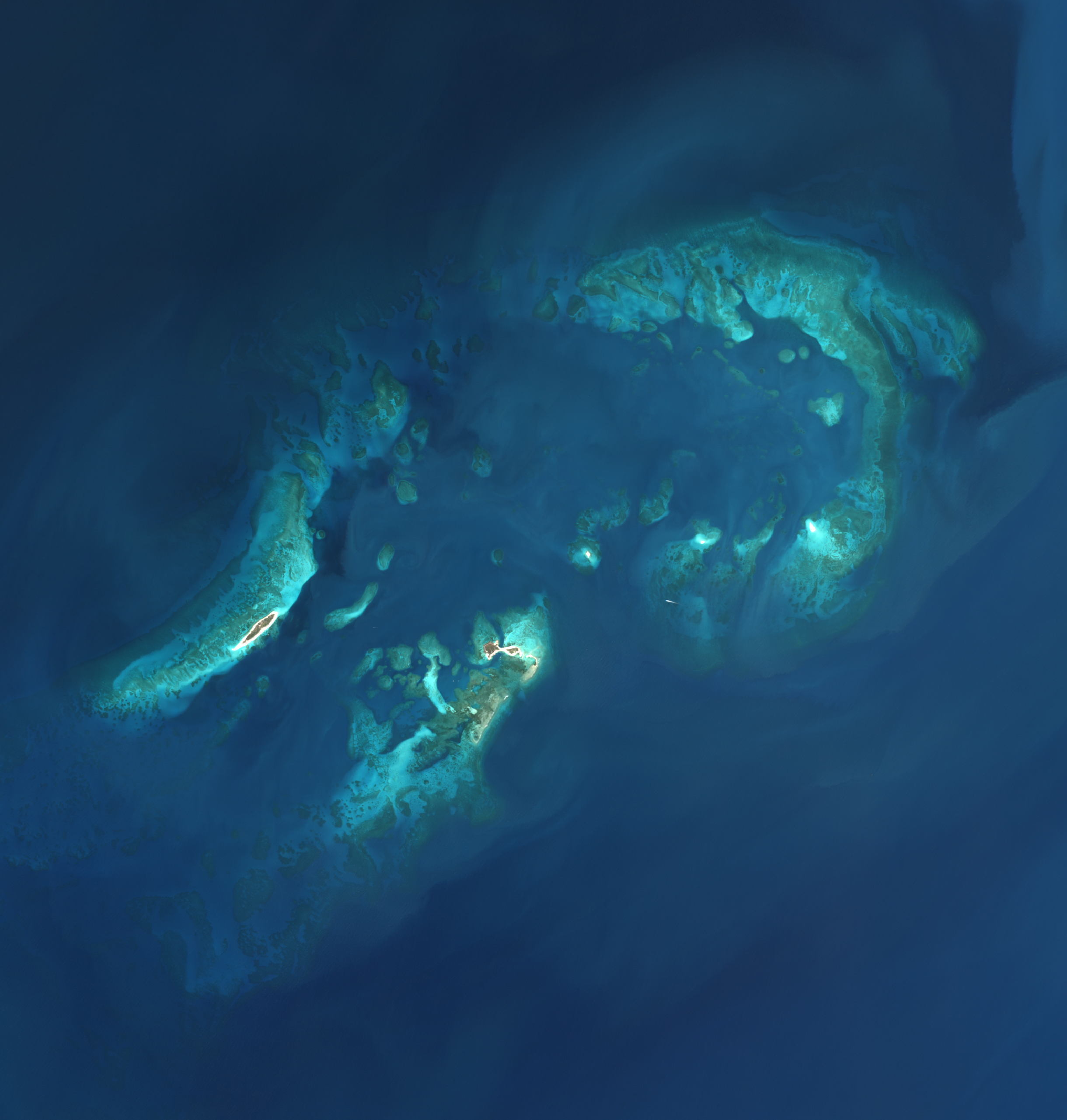
Example of a Custom Satellite Image over Dry Tortugas National Park
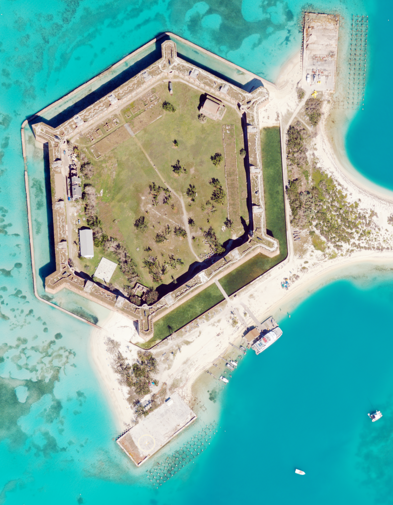
Zoomed in example of a Custom Aerial Image over Dry Tortugas National Park
Contact us
Interested in working together? Fill out some info and we will be in touch shortly. We can’t wait to hear from you!