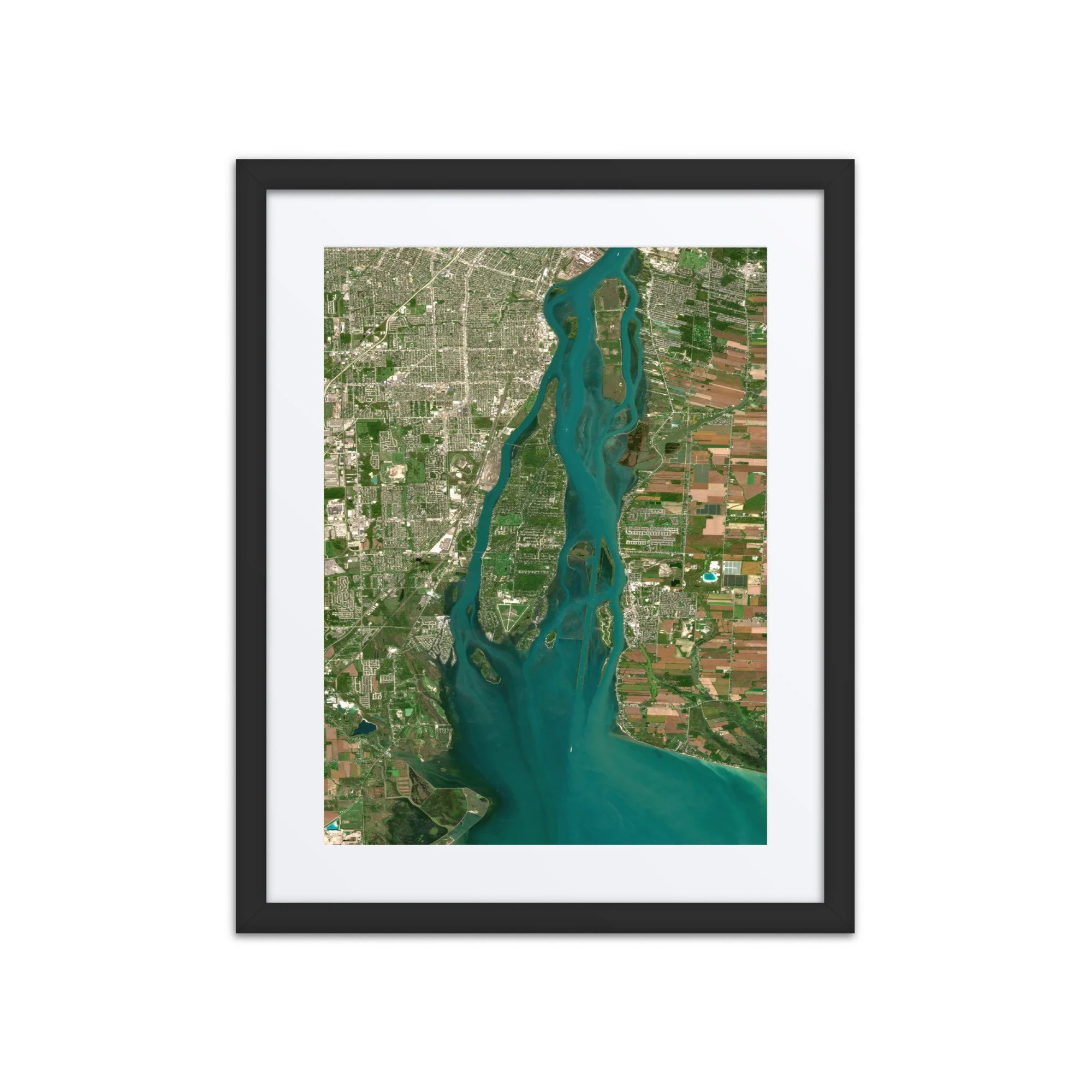
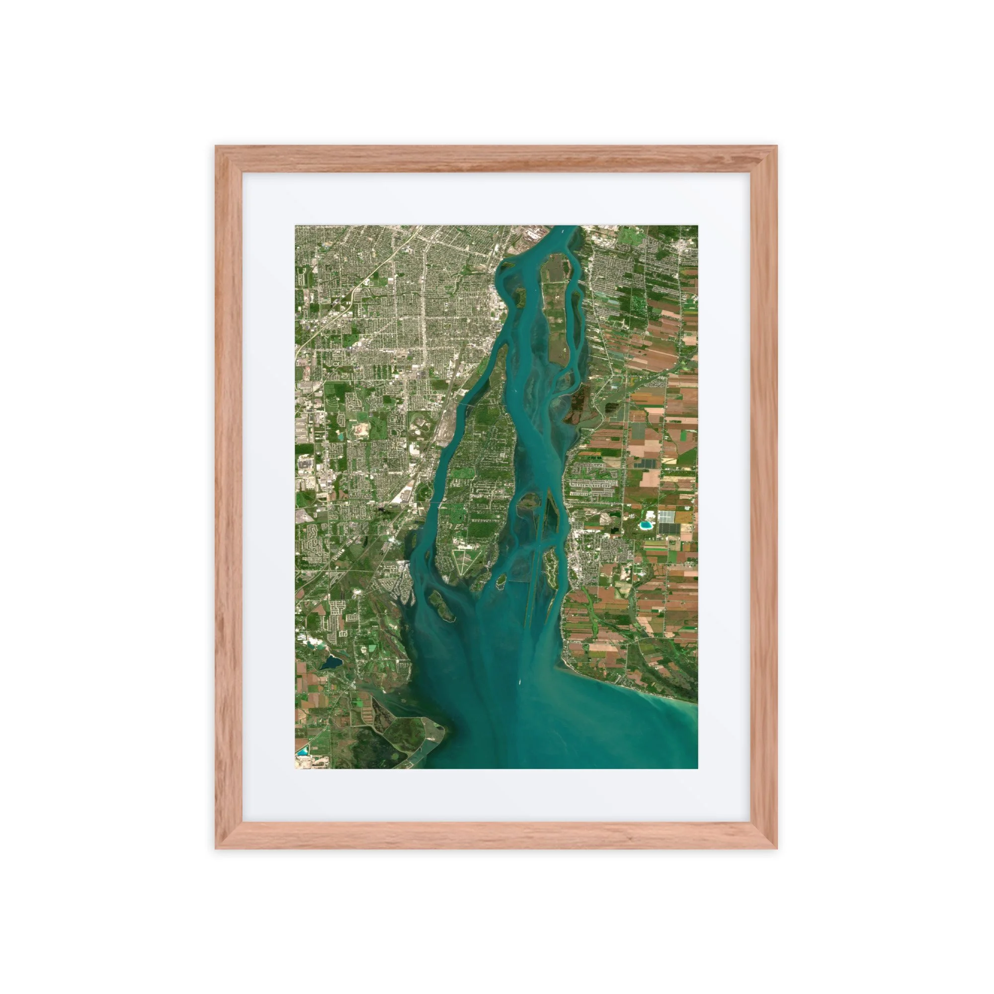
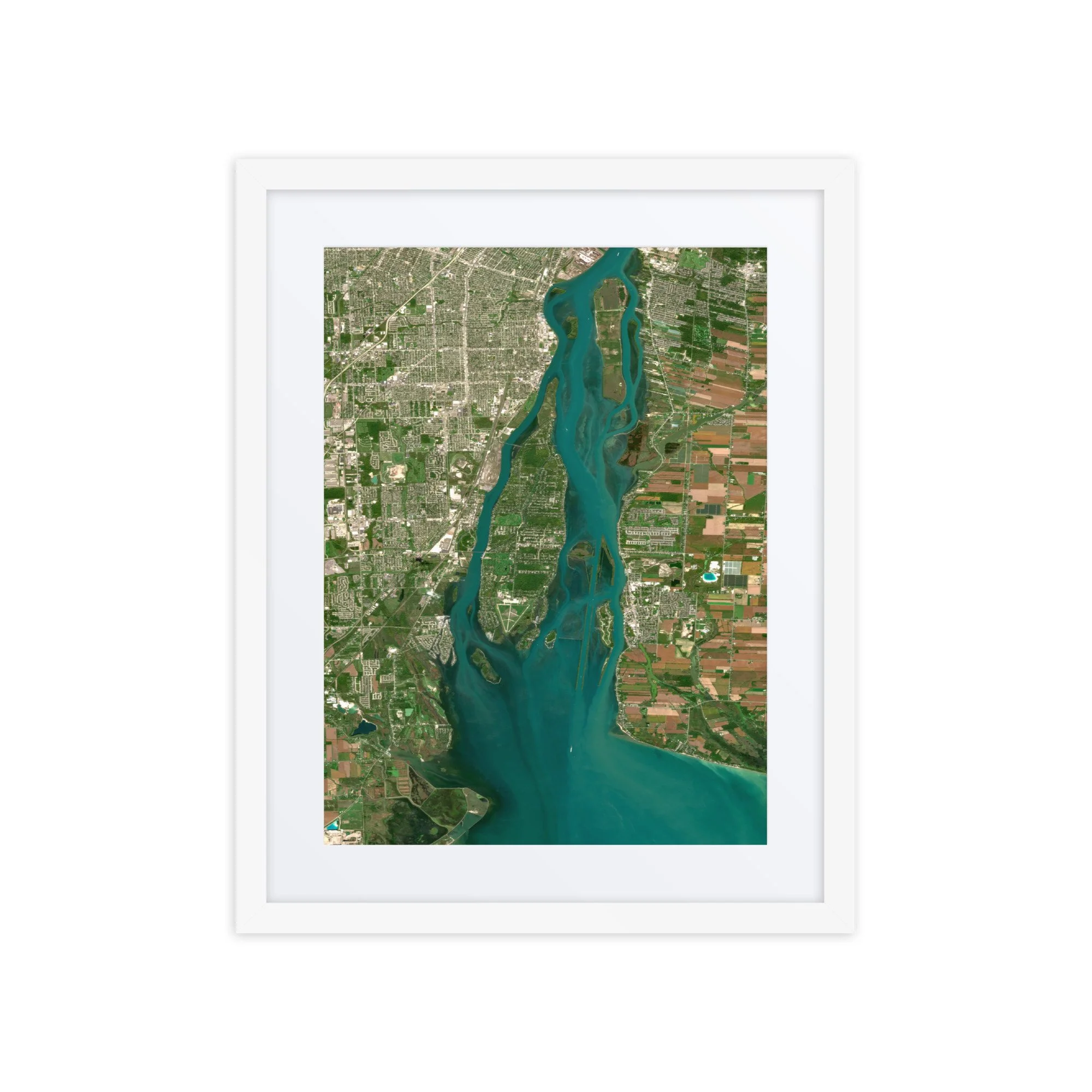
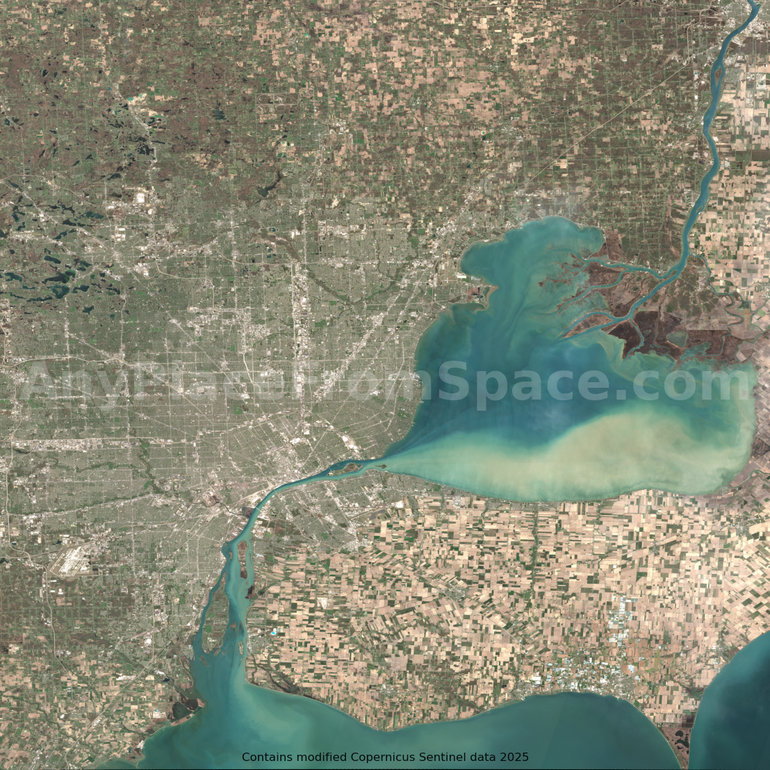
This stunning satellite image showcases Grosse Ile and the Detroit River in southeastern Michigan, captured on October 5, 2026, by the Sentinel-2 satellite. From space, the region's intricate network of islands, waterways, and coastal communities creates a remarkable landscape where the Great Lakes meet the urban and agricultural environments of Michigan and Ontario.
At the center of the image, Grosse Ile Township stretches along the Detroit River, surrounded by deep blue and turquoise waters. The island's residential neighborhoods, wooded areas, and distinctive airfield are clearly visible, while the surrounding channels and smaller islands reveal the complex geography of this important international waterway.
To the west, the sprawling suburbs of metropolitan Detroit extend across southeastern Michigan, while the eastern side of the river reveals the agricultural fields and communities of Essex County, Ontario, Canada. At the southern end of the image, the Detroit River opens into Lake Erie, where shallow waters, sediment patterns, and coastal wetlands create beautiful variations in color.
The image also highlights the region's remarkable natural and human geography, including the Detroit River International Wildlife Refuge, which protects important island, wetland, and coastal habitats along one of North America's busiest waterways.
Whether you call Grosse Ile home, have memories of the Detroit River, or simply appreciate the beauty of the Great Lakes region, this satellite image offers a unique perspective on a meaningful place from above.
Additional Information
Location: Grosse Ile, Detroit River, Michigan, USA
Image Date: October 5, 2026
Imagery Source: Copernicus Sentinel-2
File Format: High-resolution PNG
Delivery: Instant digital download
Perfect For:
Home or office wall art
Gifts for Grosse Ile and Downriver Michigan residents
Great Lakes and boating enthusiasts
Michigan and Detroit-area keepsakes
Desktop and mobile wallpapers
Print-ready artwork
Geography and satellite imagery enthusiasts
Processing Note: This image has been carefully processed to produce vibrant natural color while preserving the geographic detail captured by the Sentinel-2 satellite.
Attribution: Contains modified Copernicus Sentinel data 2026. Image processed by Any Place From Space.
Looking for another location?
Want a satellite image of your hometown, favorite island, lake, vacation destination, or another meaningful place on a specific date?
Submit a custom request here:
https://www.anyplacefromspace.com/custom-image-request
This stunning satellite image showcases Grosse Ile and the Detroit River in southeastern Michigan, captured on October 5, 2026, by the Sentinel-2 satellite. From space, the region's intricate network of islands, waterways, and coastal communities creates a remarkable landscape where the Great Lakes meet the urban and agricultural environments of Michigan and Ontario.
At the center of the image, Grosse Ile Township stretches along the Detroit River, surrounded by deep blue and turquoise waters. The island's residential neighborhoods, wooded areas, and distinctive airfield are clearly visible, while the surrounding channels and smaller islands reveal the complex geography of this important international waterway.
To the west, the sprawling suburbs of metropolitan Detroit extend across southeastern Michigan, while the eastern side of the river reveals the agricultural fields and communities of Essex County, Ontario, Canada. At the southern end of the image, the Detroit River opens into Lake Erie, where shallow waters, sediment patterns, and coastal wetlands create beautiful variations in color.
The image also highlights the region's remarkable natural and human geography, including the Detroit River International Wildlife Refuge, which protects important island, wetland, and coastal habitats along one of North America's busiest waterways.
Whether you call Grosse Ile home, have memories of the Detroit River, or simply appreciate the beauty of the Great Lakes region, this satellite image offers a unique perspective on a meaningful place from above.
Additional Information
Location: Grosse Ile, Detroit River, Michigan, USA
Image Date: October 5, 2026
Imagery Source: Copernicus Sentinel-2
File Format: High-resolution PNG
Delivery: Instant digital download
Perfect For:
Home or office wall art
Gifts for Grosse Ile and Downriver Michigan residents
Great Lakes and boating enthusiasts
Michigan and Detroit-area keepsakes
Desktop and mobile wallpapers
Print-ready artwork
Geography and satellite imagery enthusiasts
Processing Note: This image has been carefully processed to produce vibrant natural color while preserving the geographic detail captured by the Sentinel-2 satellite.
Attribution: Contains modified Copernicus Sentinel data 2026. Image processed by Any Place From Space.
Looking for another location?
Want a satellite image of your hometown, favorite island, lake, vacation destination, or another meaningful place on a specific date?
Submit a custom request here:
https://www.anyplacefromspace.com/custom-image-request
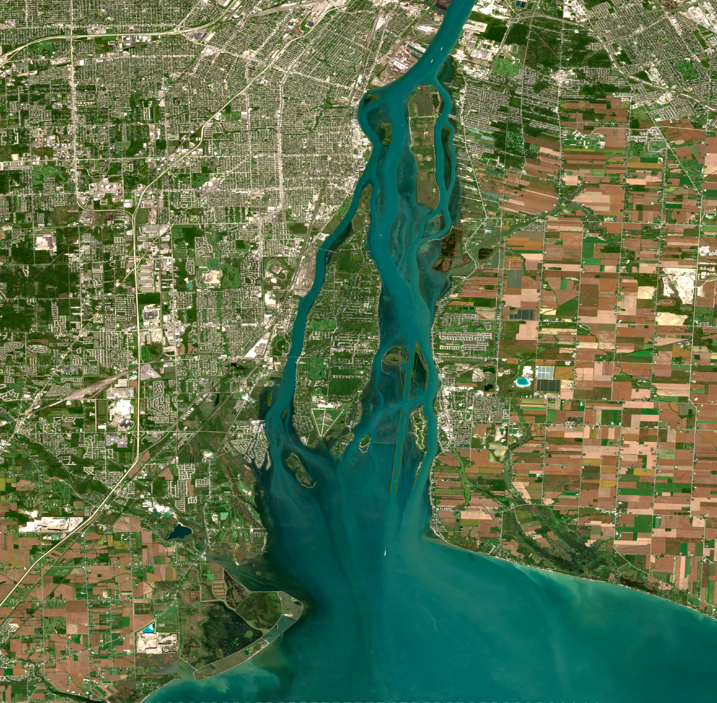 Image 1 of 1